Description du produit:
Les points forts
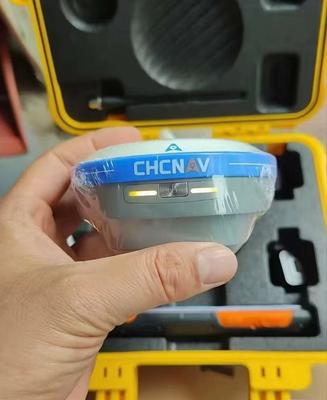
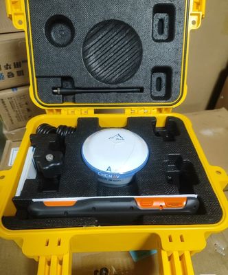
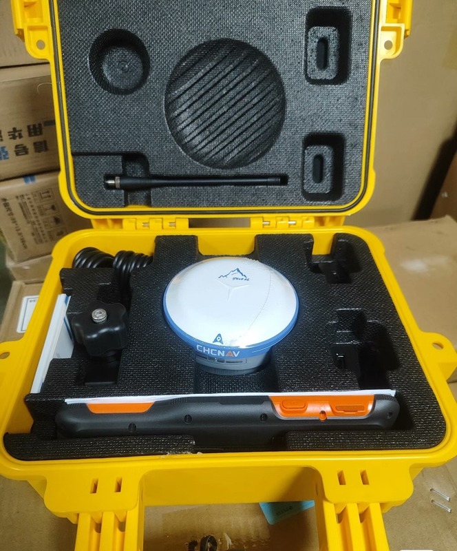
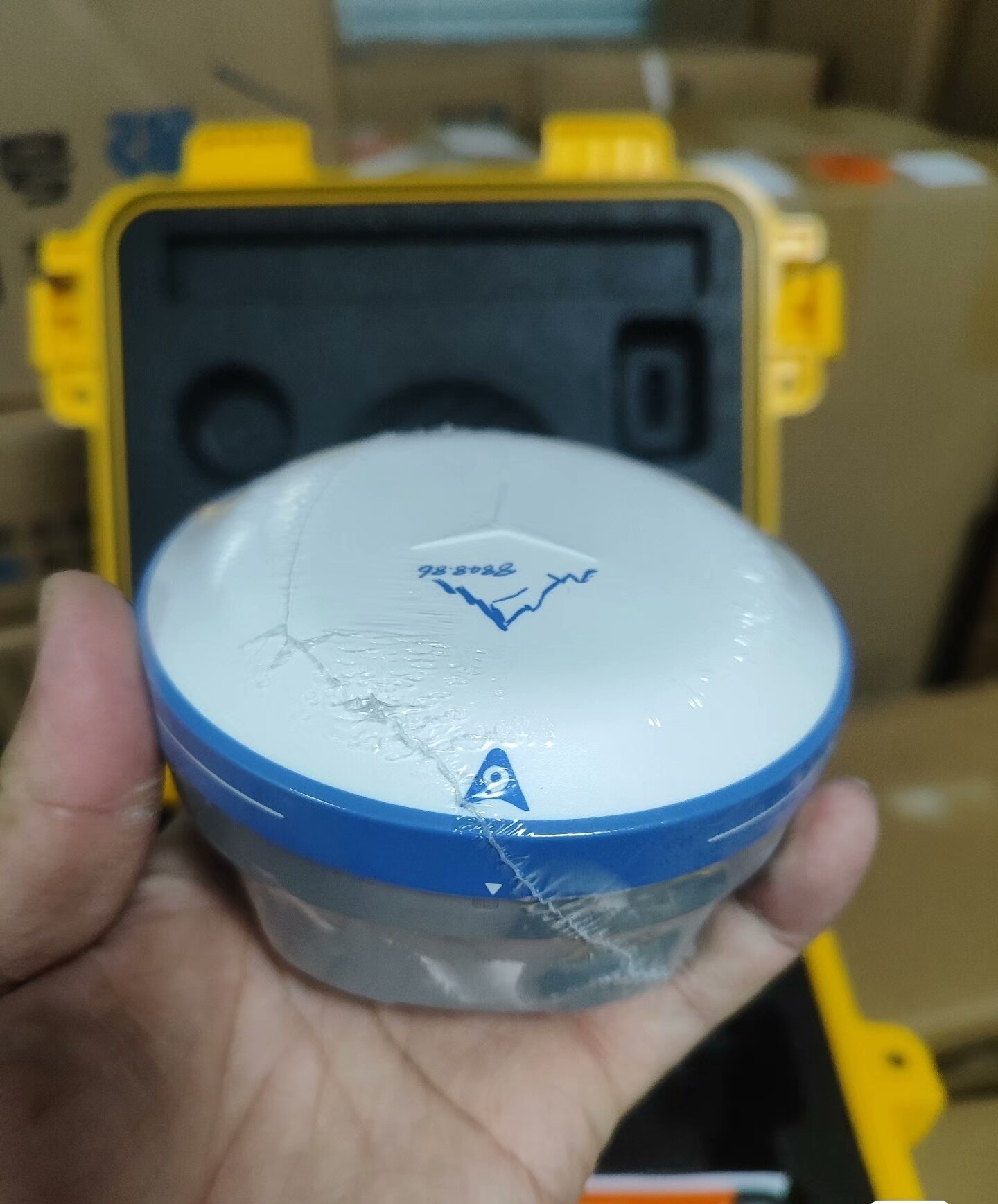
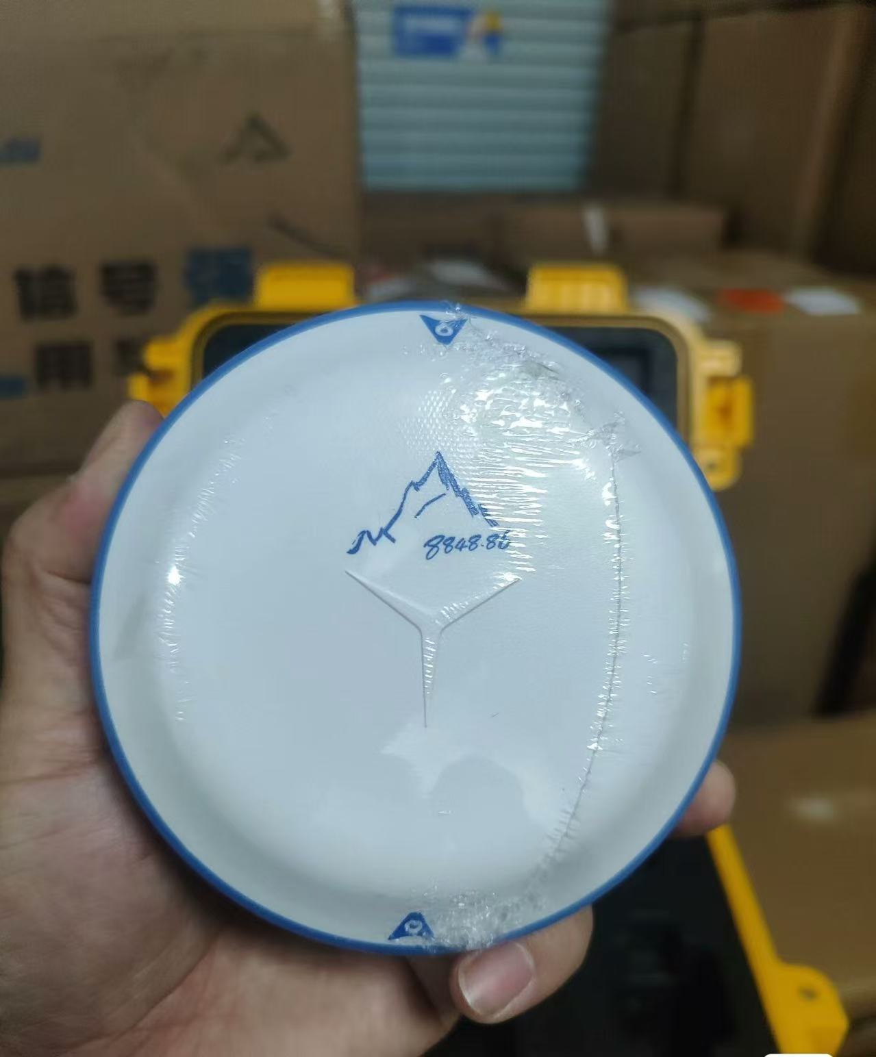
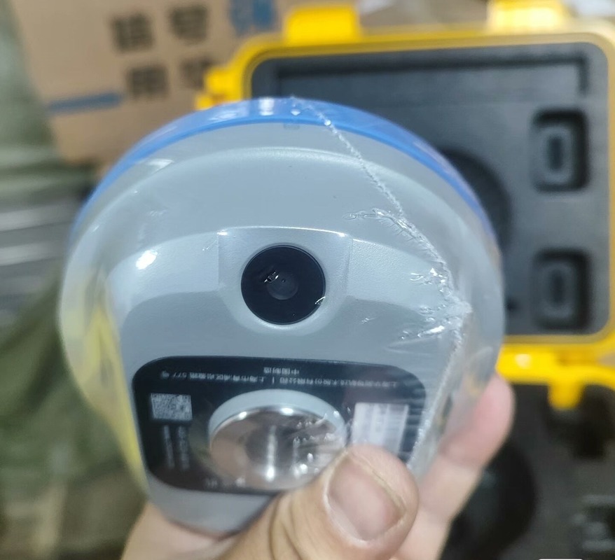
Le i76 Palm Visual RTK est un récepteur compact qui intègre GNSS, IMU et deux caméras.Le récepteur maintient un taux fixe de 96% même dans les régions à forte activité solaire, ce qui le rend très fiable pour diverses applications.
Sa fonctionnalité de surveillance visuelle CAD AR permet une planification précise du chemin, améliorant la précision et l'efficacité.En outre, l'i76 offre plus de 17 heures de vie de la batterie, offrant une utilisation étendue pour les professionnels qui ont besoin de précision et d'adaptabilité dans leur travail.
Caractéristiques:
Augmentez l'efficacité globale de la surveillance de 40% grâce à la surveillance visuelle de la CAO AR. Cette technologie intègre des cartes de base avec la réalité augmentée (RA) pour une planification précise du parcours et une visualisation en temps réel.
Atteindre une précision supérieure avec l'antenne GNSS en milieu aérien de 4e génération et la technologie iStar 2.0.assurer la fiabilité des données.
Améliorez la précision de mesure de 30% avec l'Ultra-IMU de 5e génération. Il offre une compensation automatique de l'inclinaison des poteaux jusqu'à 60°, garantissant une précision de 3 cm sans initialisation manuelle.
L'i76 intègre GNSS, IMU et deux caméras grand angle, offrant une expérience d'arpentage transparente.
Profitez de la facilité de manipulation et de la portabilité avec l'i76 de la taille d'une paume de main, pesant seulement 450 g. Sa conception compacte le rend 40% plus léger et 50% plus petit que les normes de l'industrie, améliorant les opérations sur le terrain.
Il résiste aux environnements difficiles grâce à la cote IP68 de l'i76 ′s et à la résistance à la chute de 2 mètres.
Paramètres techniques:
| - Je vous en prie. |
E1, E5a, E5b, E5 Alt-BOC: les données sont fournies par les autorités compétentes. |
| Statique de précision |
H: 3 mm + 0,1 ppm V: 3,5 mm + 0,4 ppm |
| Les États membres doivent communiquer à l'autorité compétente les informations suivantes: |
SPS-L5 |
| Énergie externe |
9.0 27.0 V de courant continu |
| L'équipement est équipé d'un système de contrôle de l'équipement. |
H: 3 mm + 0,4 ppm V: 5 mm + 0,5 ppm |
| RTK |
H: 5 mm + 0,5 ppm V: 10 mm + 0,8 ppm |
| Batterie |
Li-ion 11,600 MAh, 3,7 V |
| Radio interne (facultatif) |
Spéctrum de diffusion UHF ou FH915 de 405 à 470 MHz |
| Le système de gestion des risques |
Le système de surveillance est utilisé pour les opérations de surveillance. |
| Le BeiDou |
B1, B2 |
Applications:
L'une des caractéristiques clés du CHCNAV i76 est sa précision exceptionnelle, ce qui le rend approprié pour des applications exigeant une grande précision telles que l'arpentage, la construction, la cartographie,et de précisionLes capacités statiques de précision du récepteur, avec une précision horizontale de 3 mm + 0,1 ppm et une précision verticale de 3,5 mm + 0,4 ppm, assurent des données de positionnement fiables et précises.
Conçu et fabriqué en Chine, le CHCNAV i76 est certifié CE, garantissant sa qualité et sa conformité aux normes européennes.Les clients peuvent acheter ce produit avec une quantité minimale de commande de 1 unité à un prix compétitif de 1480 USD, avec des conditions de paiement de 100% T/T.
Avec le support des signaux BeiDou B1 et B2, ainsi que la capacité de bande L, le CHCNAV i76 offre des performances de positionnement améliorées même dans des environnements difficiles.La technologie intégrée Full Wave Fence AntennaTM avec plan au sol interne assure une forte réception du signal GNSS, améliorant encore les performances du récepteur.
Le CHCNAV i76 est polyvalent et peut être utilisé dans diverses occasions et scénarios d'application de produits.ou en utilisant la surveillance en direct pour les projets de construction, ce récepteur GNSS RTK excelle dans la fourniture de données de positionnement fiables et précises.

 Votre message doit contenir entre 20 et 3 000 caractères!