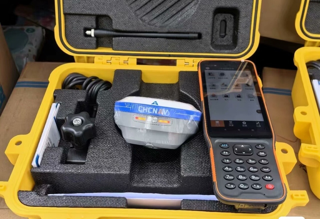
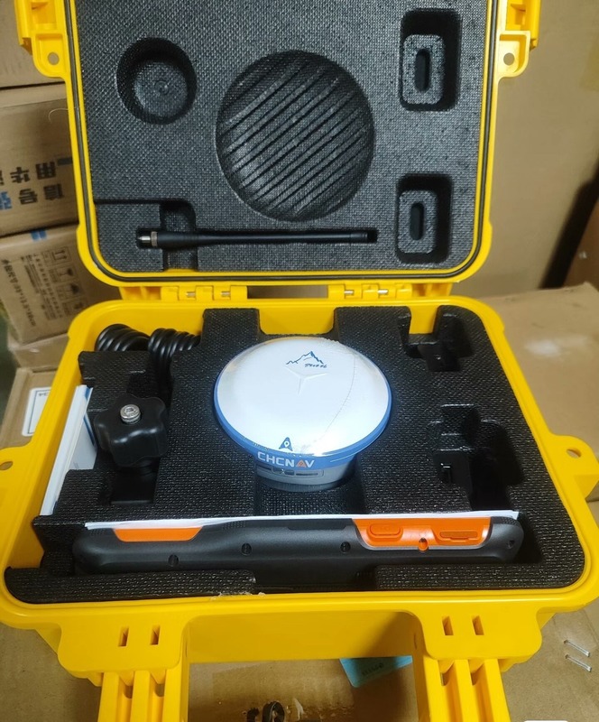
Description du produit:
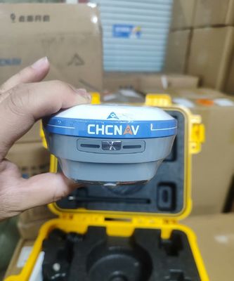
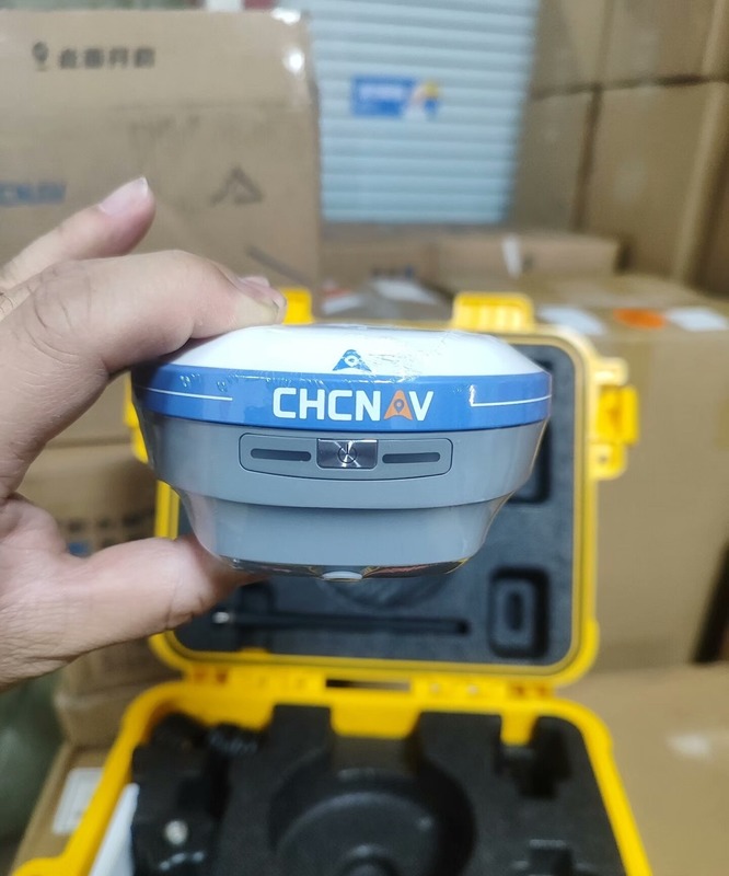
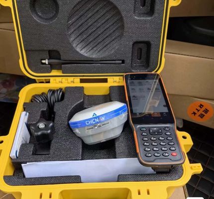
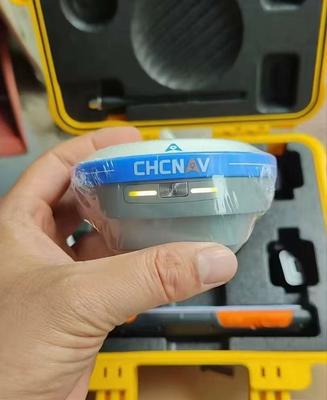
Le i76 Palm Visual RTKest un récepteur léger qui combine GNSS, IMU et deux caméras. pesant seulement 450g et classé IP68, il est conçu pour fournir des performances élevées dans diverses conditions environnementales.
L'appareil dispose d'une fonction de surveillance visuelle CAD AR, facilitant une planification précise du parcours.L' Ultra-IMU de 5e génération garantit une précision, même à une inclinaison de 60°.
Équipé d'une autonomie de plus de 17 heures, l'i76 offre aux professionnels la fiabilité dont ils ont besoin pour un travail de terrain prolongé.Sa précision et sa flexibilité en font un outil idéal pour les professionnels en quête de précision et de flexibilité dans leur travail.
Caractéristiques:
Améliorer l'efficacité de la surveillance
Découvrez une façon révolutionnaire d'augmenter l'efficacité globale de la surveillance jusqu'à 40% avec la technologie de surveillance visuelle CAD AR.Cette solution de pointe intègre parfaitement les cartes de base avec la réalité augmentée (RA) pour une planification précise des itinéraires et une visualisation en temps réel.
Une précision supérieure
Obtenez une précision supérieure en utilisant la dernière antenne GNSS en milieu aérien de 4e génération et la technologie iStar 2.0.,assurer des données cohérentes et fiables pour vos besoins d'enquête.
Améliorer la précision des mesures
Améliorez la précision de mesure jusqu'à 30% avec l'innovante Ultra-IMU de 5e génération équipée d'une compensation automatique de l'inclinaison des poteaux jusqu'à 60°,Cette unité de mesure de la température garantit une précision de 3 cm sans nécessiter d'initialisation manuelle., établissant une nouvelle norme de précision.
Une expérience de géométrie sans faille
Cette solution complète prend en charge l'observation et la mesure en temps réel.fournir une rétroaction visuelle intuitive pour une efficacité accrue sur le terrain.
Facile à manipuler et à transporter
Profitez de la facilité de manipulation et de la portabilité avec l'i76 léger et compact, pesant seulement 450g et conçu pour être de la taille d'une paume, il est 40% plus léger et 50% plus petit que les normes de l'industrie,le rendre pratique pour les opérations sur le terrain sans compromettre les performances.
Durable dans des environnements difficiles
Avec une classification IP68 et une résistance à la chute de 2 mètres, l'i76 est conçu pour résister à des conditions de terrain difficiles.fournissant une fiabilité dans des environnements difficiles pour un relevé ininterrompu.
Paramètres techniques:
| Radio interne (facultatif) |
Spéctrum de diffusion UHF ou FH915 de 405 à 470 MHz |
| Énergie externe |
9.0 27.0 V de courant continu |
| QZSS |
L1 C/A, L1C, L2C, L5 |
| Le groupe GLONASS |
L1 C/A, L1P, L2C/A, L2P, L3C |
| Statique de précision |
H: 3 mm + 0,1 ppm V: 3,5 mm + 0,4 ppm |
| Les canaux |
226 Canaux GNSS |
| GPS |
L1 C/A, L1C, L1P ((Y), L2P ((Y), L2C, L5 |
| Le système de gestion des risques |
Le système de surveillance est utilisé pour les opérations de surveillance. |
| L'équipement est équipé d'un système de contrôle de l'équipement. |
H: 3 mm + 0,4 ppm V: 5 mm + 0,5 ppm |
| - Je vous en prie. |
E1, E5a, E5b, E5 Alt-BOC: les données sont fournies par les autorités compétentes. |
Applications:
Le récepteur GNSS RTK CHCNAV i76 est un dispositif de positionnement de haute précision conçu pour un large éventail d'applications dans diverses industries.ce produit convient à plusieurs occasions et scénarios spécifiques.
L'une des principales applications du récepteur GNSS RTK CHCNAV i76 est l'arpentage et la cartographie des terres.ce qui le rend idéal pour capturer des données géospatiales précises pour créer des cartes, des modèles, et la réalisation d'enquêtes.
Les professionnels de la construction et de l'ingénierie peuvent également bénéficier du récepteur GNSS RTK CHCNAV i76.25 mètres et précision verticale inférieure à 0.50 mètres, permettant un positionnement précis pour la mise en page de la construction, la planification du site et les applications de contrôle de la machine.
En outre, le récepteur GNSS RTK CHCNAV i76 est bien adapté à une utilisation agricole.Les agriculteurs et les agronomes peuvent tirer parti de ses capacités BeiDou et GLONASS pour obtenir un positionnement précis pour des tâches d'agriculture de précision telles que la surveillance des cultures, des systèmes de cartographie et de guidage.
Les géomètres travaillant dans des environnements difficiles peuvent compter sur le récepteur GNSS RTK CHCNAV i76 pour des performances fiables.600 mAh assure un fonctionnement prolongé sur le terrain, ce qui le rend adapté aux enquêtes de longue durée et aux missions de collecte de données.
Qu'il soit utilisé pour l'arpentage géodésique, la collecte de données SIG ou le développement d'infrastructures, le récepteur GNSS CHCNAV i76 RTK de Chine est un outil polyvalent et fiable.Avec certification CE et quantité minimale de commande de 1 unité, ce produit est accessible aux professionnels à la recherche de solutions de positionnement de haute précision.
Disponible au prix de 1480 USD avec des conditions de paiement de 100% T/T, le récepteur GNSS RTK CHCNAV i76 offre une valeur exceptionnelle pour ses fonctionnalités et ses performances avancées.Choisissez cet appareil pour vos besoins RTK GNSS et l'expérience de positionnement fiable et précis dans divers scénarios d'application.

 Votre message doit contenir entre 20 et 3 000 caractères!